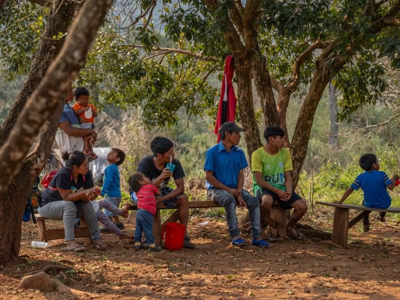
The landholding of Señor Cordoba used for the mapping exercise in Peñalosa
In the northern tip of Colombia in the Caribbean municipality of Acandí, Department of Chocó, a close-knit Afro-descendent community recently took its first steps to map its members’ tenure rights, using Open Tenure through a specific hands-on training in the framework of the ongoing UN-REDD technical assistance.
Open Tenure is an open source software for data collection and processing developed by the Food and Agriculture Organization of the United Nations (FAO). It helps communities, NGOs and other institutions to record tenure rights, guiding the user to collect information on the claimant, the documentary evidence of the tenure rights, and the geospatial boundaries of the claim.
The training, primarily targeting community members and young people, included a practical exercise in the Peñaloza Consejo (local council) during which small teams used Open Tenure to demarcate several parcels of land owned by an elder in the community. Participants also learned how to upload data and polygons collected in the field to a community-owned computer where the claims can be reviewed and edited as needed by designated moderators. This computer serves as the hub for tenure data and will be managed by the community itself. With the training phase coming to an end, now it is up to the community to take this work forward by rolling out the tenure data collection campaign in each of the 9 consejos.
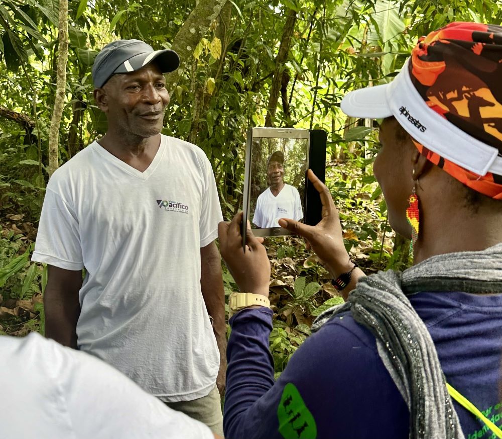
Data collection with Señor Cordoba in Peñalosa during the Open Tenure field exercise
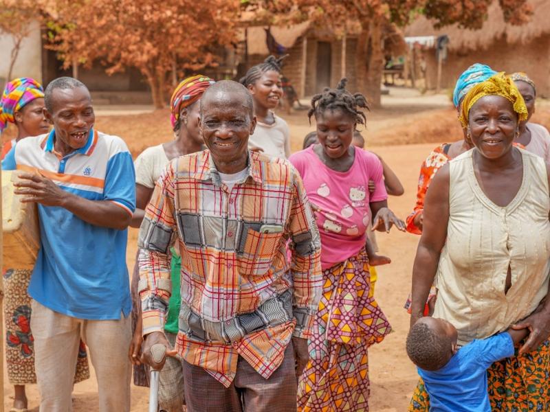
COCOMASUR works for the preservation of their cultural identity and the orderly management of their territory
COCOMASUR (which stands for ‘Consejo Comunitario de Comunidades Negras de la Cuenca del Río Tolo y Zona Costera Sur/ Black Communities of the Tolo River Basin and Southern Coastal Zone) is a robust community organization that enhances local governance and infrastructure, fostering both social cohesion and sustainable development. There are 603 member households across this coastal region, organized into 9 local councils (known as ‘consejos’).
COCOMASUR has a dedicated administrative center with a new community hall used for trainings, cultural events, and community meetings. The center is also used to promote youth education; many young people are engaged in online university courses using the available computers and internet.
Trained educated young people are expected to bring skills back to the community and contribute their knowledge to long term development. Students choose a range of courses from ecotourism management to communications. In addition, COCOMASUR has strengthened its governance capacity by conducting a community census, gathering basic data on its members. This integrated approach not only improves local governance but also empowers the community to plan strategically for future needs and opportunities.
COCOMASUR has been fighting to gain recognition of its land and resource rights in Colombia over the last several decades. The area where COCOMASUR is located is rich in both tropical forest (covering 13 500 ha) and marine resources, famous as a habitat for the endangered Caná and Carey tortoises and a range of other endemic species (e.g. tití, guacharaca). For generations, the community has used and protected its natural resources sustainably. The 1993 passage of the law ‘Ley 70’, was a landmark decision in this struggle, which allowed the community to obtain legal recognition of its collective territorial rights covering over 39 000 ha.
Subsequently, COCOMASUR identified protection zones for important flora and fauna, including protected areas for native forests to the west and a marine sanctuary to protect the endangered tortoises to the East. COCOMASUR conducts forest monitoring to enforce the community’s conservation goals.
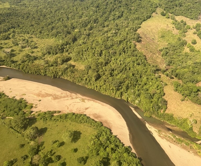
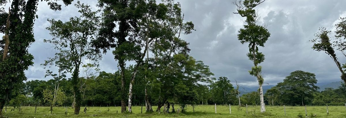
View of the Tolo River in the COCOMASUR territory
Partnerships to overcome the challenges
Despite significant progress, COCOMASUR faces some key challenges, particularly in protecting its resources and maintaining its territorial rights.
One major issue is encroachment on the forest by outsiders, due to land grabbing. This issue is encountered across the country and has been identified as the most common driver of deforestation.
To address these challenges, COCOMASUR has been collaborating closely with FAO, the Institute of Hydrology, Meteorology and Environmental Studies (IDEAM), and the Ministry of Environment and Sustainable Development since 2016, within the framework of the UN-REDD Programme. Since 2021, this collaboration has focused specifically on the Open Tenure tool and sustainable forest management (SFM).
This partnership aims to strengthen forest monitoring and community forestry capacities, highlighting the crucial role of local communities in the sustainable use, management, and conservation of forests at the national level. Such partnership helps clarify individual or household tenure rights within the collectively owned territory. By gaining a clearer understanding of which community members are cultivating or residing in specific areas, the process of resource transfers will be smoother, such as in the event of inheritance.
This initiative also aims to reduce the vulnerability of women, who often face barriers to tenure rights typically granted to male family members (such as sons or uncles). Additionally, clearer tenure rights will help to defining the location and claimants of resources.
While COCOMASUR requires additional financial support to sustain its initiatives and maintain its protection efforts, there are high hopes for the community. Given its strong dedication and youthful energy and commitment, COCOMASUR can be a model in Colombia for the use of technology to systematically clarify and strengthen the management of community tenure rights and forest governance.